
Powered by KC Drone Co.
"Any Farm, Any Time , Anywhere"
The largest network of FAA- approved ag drone service providers and agronomists
Services
Stand Count
Combine stand count with planting rate to determine your actual emergent rate. This must be done early in the growing season before the crop goes full canopy..

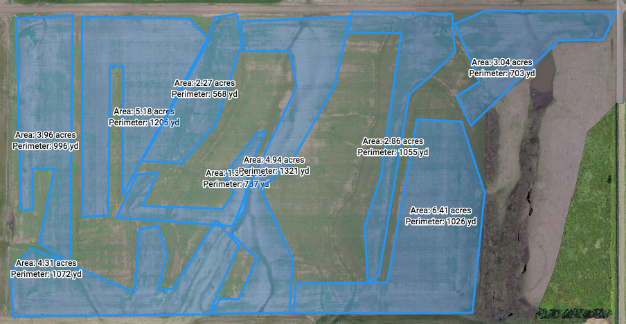
Variable Rate Prescription for nitrogen application
Compare the NDVI map to the yield map on a field that was not treated with variable rate Nitrogen. Agronomists interpret the aerial NDVI data to create a variable rate prescription for mid-season nitrogen application.
Crop Insurance Claim Verification
Whether it is green snap or water damage, we provide the producer with an independent 3rd party verification of actual damage across the entire field.

ABOUT
Fly Ag Tech is the nation's first and largest network of FAA-approved ag drone service providers and agronomists. We are not selling mapping software or drones. We are actual drone service providers who help you solve production problems. We combine the most current mapping software with the most current sensors. Our in-house agronomists understand how to interpret our maps to help you with on-farm decisions.

PRODUCTS
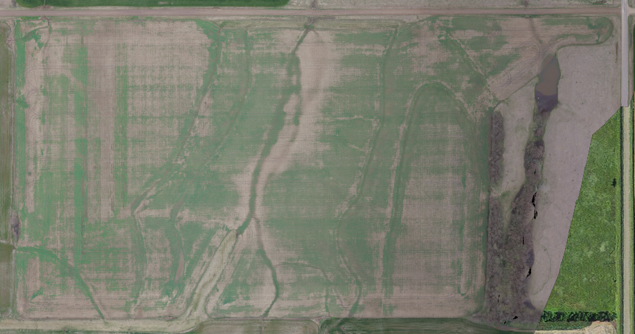
This winter crop was damaged by extreme temperatures.
Our analysis of the damaged field shows more than 50% winter kill.

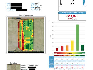
This is a Stand Count Report of a corn field.
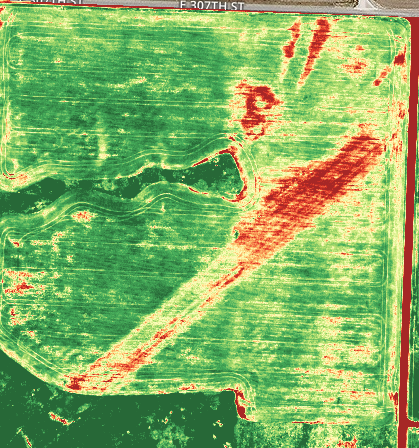
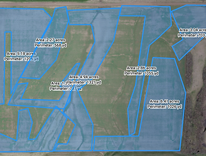
This map shows yield lag. A utility company did not return the field to original condition after a pipeline installation.
CLIENTS


CONTACT
For a free consultation of our capabilites or general questions, please fill out the following form.
We are hiring ag drone pilots and seeking FAA Approved operators to join our network. If you are interested, please call or fill out the email form.
Headquarters
405 Southwest Blvd
Kansas City, MO 64108
Tel: 816.673.3061